
|
Why is Colombia one of the most biodiverse places on this planet? When did the Northern Andes form and how are the Andes connected to the deep dynamics of the Nazca subduction zone? I am investigating how recent changes in geometry of the tectonic plate subducting below South America changed topography, and drove the evolution of animal and plant species in Colombia. I also investigate how subduction processes changed the drainage patterns and sediment routing systems. Check out our first paper on the topography of the Northern Andes. LINK (contact me on ResearchGate or per Email if you do not have access to Elsevier journals) We've also analyzed a bunch of new samples for denudation rates, and I am preparing a project with a Colombian molecular biologist. Therefore, you can look forward to exciting new papers on these topics in the future. |
Uplift of the Northern Andes and its implications for earthquake hazards and biodiversity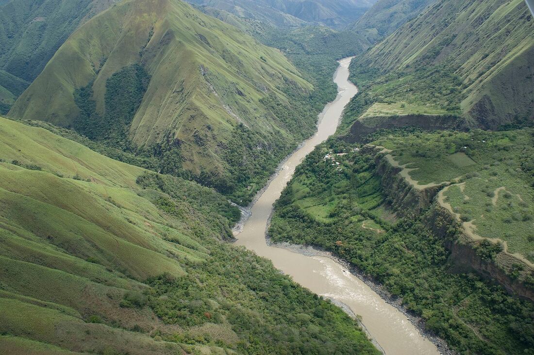
|
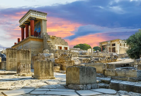
Quantifying the effects of human landuse on erosion - Did the Minoans cause their own demise?
|
Loss of fertile land due to soil erosion is a major global environmental and agricultural threat. Every year, arable land equivalent to the size of Cuba is lost due to human-induced erosion, threatening food supplies and accelerating climate change due to additional CO2 release. This project aims to use novel geochemical techniques to quantify changes in modern soil erosion rates across landscapes with different land use histories and compare them against rates from ancient civilizations that are thought to have collapsed due to self-induced soil erosion.
I investigate this problem also in respect to the sudden demise of the first advanced European civilization, the Minoans on Crete. Their collapse has been hotly debated for many decades and we try to shed new light on the hypothesis that they caused their own demise by overusing the land they lived from. |
Tectonics of the Hellenic Subduction Zone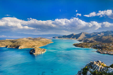
|
Are great earthquakes and tsunamis possible or even common in the Mediterranean? Most tourists do not really considering this while lying at the beaches of Crete...
During my PhD I mapped and dated paleoshorelines on Crete to determine rates and patterns of vertical land movements on different time-scales (Pleistocene and Holocene). I use these information to constrain geodynamic models of the Hellenic Subduction Zone. On shorter time-scales, I use these data to constrain earthquake and tsunami hazard for the Eastern Mediterranean. Here's our EPSL paper in which we use the rates and patterns of uplift of Pleistocene paleoshorelines to constrain tectonic models in the Hellenic Subduction Zone. Another study investigating the largest reported earthquake in the Mediterranean in AD 365 has recently been published in AGU Advances. And hopefully more to come soon... |
|
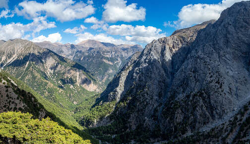
Did you ever notice that many carbonate mountains especially around the Mediterranean are very steep compared to mountains of other rock types?
On Crete this observation and how denudation in Mediterranean carbonate areas is partitioned into mechanical erosion and chemical weathering. We use cosmogenic nuclides, together with water chemistry data and numerical modelling to show the dominance of mechanical erosion in these settings and how infiltration leads to the development of steep topography. Check out our JGR Earth Surface paper. We have expanded these approaches to other regions with a global compilation of cosmogenic nuclide measurements and wathering rates. We show that in humid, slowly uplifting regions, carbonates are associated with low-lying, flat topography because slope-independent chemical weathering dominates denudation. In contrast, in arid climates with rapid rock uplift rates, carbonate rocks form steep mountains that facilitate rapid, slope-dependent mechanical erosion required to compensate for inefficient chemical weathering and runoff loss to groundwater systems. This result suggests that carbonates represent an end member for interactions between climate, tectonics, and lithology. With the funding support from Nagra, we developed new methods to quantify long-term denudaiton and weathering in limestone setting. Carbonates cover more than 20% of the world but currently we lack ways of determining denudation in these areas. We try to adapt conventional cosmogenic nuclide approaches to the special conditions in carbonates. |
Denudation partitioning and landscape evolution in carbonate regions
|
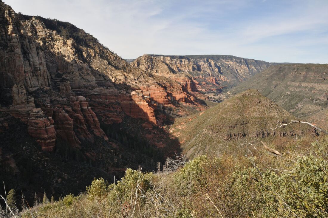
Uplift and Canyon incision of the southwestern Colorado Plateau
|
How old is the Grand Canyon? Is it only 6 million or 70 million years old? And when did the Colorado Plateau uplift?
To shed some light on these questions Kelin Whipple send me out to map the unconformities, do sediment provenance and date lava flows around the Verde Valley in Arizona. We managed to reconstruct the evolution of the canyons cutting into the southwestern Colorado Plateau and used their incision histories to constrain the Colorado Plateau uplift. We couldn't find any evidence of recent (< 10 million year) plateau uplift, rather it seemed like most relief was established more than 15 million years ago and mostly related to integration of river systems. Check out our paper. |
